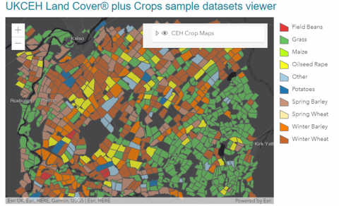
UKCEH Land Cover® plus: Crop maps were the first detailed, interactive, digital maps of cropping in Great Britain. Two million land parcels are categorised within the Land Cover Map spatial framework, providing information on annual crop types for every field in Great Britain.
To date, UKCEH Land Cover® plus: Crop maps have been produced for 2015 (partial GB coverage), 2016, 2017, 2018, 2019, 2020 and 2021. Crop maps are available each autumn, with advance maps of Oilseed Rape accessible from August each year.
Developed in collaboration with Remote Sensing Applications Consultants Ltd (RSAC), the maps exploit satellite data - Copernicus Sentinel-1 C-band SAR (Synthetic Aperture Radar) and, from 2016 onwards, Sentinel-2 optical data.
The crops from 2016 onwards are winter wheat (including oats), spring wheat, winter barley, spring barley, oilseed rape, field beans, potatoes, sugar beet, maize, and improved grass. Other cereals, root crops, early potatoes, and vegetables are grouped in a class called ‘other’, together with a small number of parcels which could not be classified. From 2020, solar fields (sites with solar panels at ground level) are also included.