Living England: From Satellite Imagery to a National Scale Habitat Map
Post from Natural England website:
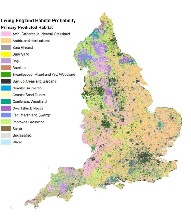
A new map that shows the extent and distribution of habitats in England has been launched on 5 April 2022. This probability map, which is freely available to view and use, will provide important data for environmental policy decision making, and can guide efforts to support nature’s recovery. The Living England team tells us more about this highly anticipated product and why its release is so exciting...
What is Living England?
Living England is a multi-year project which delivers a habitat probability map for the whole of England, created using satellite imagery, field data records and other geospatial data in a machine learning framework. The Living England habitat probability map shows the extent and distribution of broad habitats across England, providing a valuable insight into our natural capital assets and helping to inform land management decisions. It is funded by and supports the Environmental Land Management (ELM) Schemes and the Natural Capital and Ecosystem Assessment (NCEA) Programme.